iTown is a Free Framework for Visualizing 3D Geospatial data in Your Browser


What is iTowns?
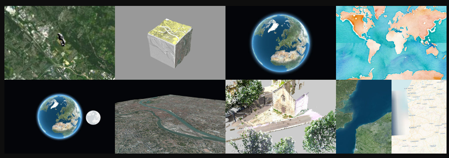
iTowns is a Javascript/WebGL framework for visualizing 3D geospatial data. It can connect to various servers, load different data formats, and targets the last two major versions of Firefox, Safari, and Chromium-based browsers.
Features
- Visualizes 3D geospatial data
- Connects to various servers
- Loads different data formats, including 3dTiles, GeoJSON, Vector Tiles, GPX, and more
- Targets the last two major versions of Firefox, Safari, and Chromium-based browsers
- Supports WMS/WMTS/TMS servers, including elevation data
- Older browsers supporting WebGL 2.0 may work but support is not offered
License
iTowns is dual-licenced under Cecill-B V1.0 and MIT. Incorporated libraries are published under their original licences.
Resources & Downloads
GitHub - iTowns/itowns: A Three.js-based framework written in Javascript/WebGL for visualizing 3D geospatial data
A Three.js-based framework written in Javascript/WebGL for visualizing 3D geospatial data - iTowns/itowns
 iTowns
iTowns