TerriaJS is a feature rich open source solution for building amazing spatial data federation web platforms.
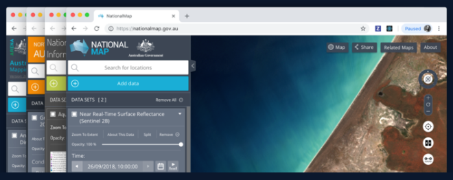
TerriaJS powers world-leading platforms such as Australia's NationalMap and the New South Wales Digital Twin Visualisation Service and facilitates the exploration of satellite imagery from Digital Earth Australia. Data publishers can assemble catalogues of spatial datasets with a combination of hand curation and federation - live querying of online data services.
Features
3D AND 4D VISUALISATION: Visualise your data on 3D terrain, fall back to 2D on older systems or switch between them on the fly, based on Cesium and Leaflet.
Comparison tools
Charting
Supports time series
Live data catalogs
It supports varies geospatial formats
Geoprocessing
Automatic region mapping
Responsive user-friendly interface
Export data stories
Automatic changes detection
Comes with a strong scene editor
License
The project is released as an open-source under the Apache 2.0 License
This is a small lightweight Python + JavaScript project that enables you to scrap Google Map leads in almost no time.
Features
1. Scrape up to 1200 Google Map Leads in just 25 minutes, providing you with an extensive pool of potential customers to drive sales.
2. Access 30 Data Points,
Raven - Advanced Cyber Threat Map (Simplified, customizable and responsive. It uses D3.js with TOPO JSON, has 247 countries, ~100,000 cities, and can be used in an isolated environment without external lookups!.
Panel is an open-source Python library that lets you easily build powerful tools, dashboards, and complex applications entirely in Python. It has a batteries-included philosophy, putting the PyData ecosystem, powerful data tables and much more at your fingertips.
Features
High-level reactive APIs and lower-level callback based APIs ensure you can
Business Intelligence, commonly known as BI, is the process of collecting, analyzing, and presenting data to make informed business decisions. BI helps organizations to transform their raw data into meaningful insights that can drive their business strategies. BI provides a range of advantages to organizations, including improved decision-making, increased efficiency,
QuakeFeed is a lightweight free iOS app that notify and alert users with earthquakes. It uses multiple sources, uses an interactive map, and contains a historical data back to 1900.
With its latest update, the app also supports wildfires, hurricanes, and erupting volcanoes.
Features
1. Simple clutter-free interface
2. Browse
Bike Router is an interactive open-source map app that can help you plan your cycling trips. It allows you to set the start point, end point and several mid-points for your trip.
It calculates and display the path, distance, and routes on a map and a visual graph.
The project
Designing maps might seem easy, but it is not, especially when many tools require certain levels of technical knowledge. A good map design can promote your presentation, website, and increase your work exposure.
Data scientists, business analysts, marketeers, advertisers, and many other professions require map design in their daily work.
CesiumJS is a JavaScript library for creating 3D globes and 2D maps in a web browser without a plugin. It uses WebGL for hardware-accelerated graphics, and is cross-platform, cross-browser, and tuned for dynamic-data visualization.
CesiumJS can stream 3D content such as terrain, imagery, and 3D Tiles from the commercial Cesium