
Visualization
16 Open-source Library and Frameworks to Build 3D Maps and 3D Globe!
From CityGML to SLAM: 16 Essential Open-Source Geospatial Apps for Developers
Visualization
From CityGML to SLAM: 16 Essential Open-Source Geospatial Apps for Developers

macos
If you're working with 3D city models, whether it’s for urban planning, smart cities, digital twins, or geospatial research, azul is a game-changer. This powerful, open-source viewer lets you explore CityGML, CityJSON (1.0, 1.1, 2.0), IndoorGML, OBJ, OFF, and POLY files, all in one

Python
Before we start, it is important to add the following Disclaimer by the project creators. Disclaimer for Google Maps Scraper Project This Google Maps Scraper is provided for educational and research purposes only. By using this Google Maps Scraper, you agree to comply with local and international laws regarding data
BI
This is a small lightweight Python + JavaScript project that enables you to scrap Google Map leads in almost no time. Features 1. Scrape up to 1200 Google Map Leads in just 25 minutes, providing you with an extensive pool of potential customers to drive sales. 2. Access 30 Data Points,

Open-source
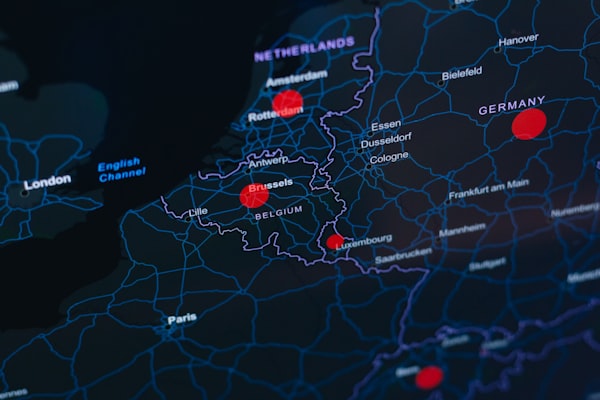
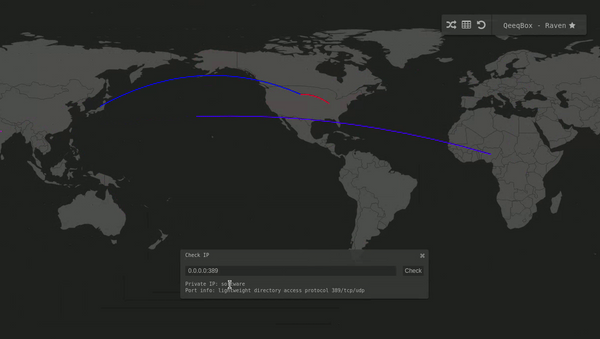
Raven - Advanced Cyber Threat Map (Simplified, customizable and responsive. It uses D3.js with TOPO JSON, has 247 countries, ~100,000 cities, and can be used in an isolated environment without external lookups!.
macos
Inkscape is a Free and open source vector graphics editor for GNU/Linux, Windows and macOS. It offers a rich set of features and is widely used for both artistic and technical illustrations such as cartoons, clip art, logos, typography, diagramming and flowcharting. It uses vector graphics to allow for
macos
Takes 2D GIS datasets (e.g. topographical datasets) and "3dfies" them (as in "making them three-dimensional") by lifting every polygon to 3D. The elevation is obtained from a point cloud (we support LAS/LAZ at this moment), and the semantics of every polygon is used to
macos
OpenSCAD is a software for creating solid 3D CAD objects. It is free software and available for Linux/UNIX, MS Windows and macOS. Unlike most free software for creating 3D models (such as the famous application Blender), OpenSCAD focuses on the CAD aspects rather than the artistic aspects of 3D
Cybersecurity
Advanced Cyber Threat Map (Simplified, customizable, responsive and optimized)
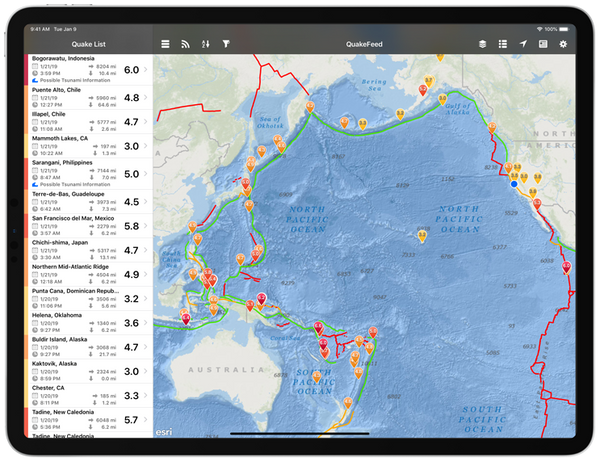
Crisis Management
QuakeFeed is a lightweight free iOS app that notify and alert users with earthquakes. It uses multiple sources, uses an interactive map, and contains a historical data back to 1900. With its latest update, the app also supports wildfires, hurricanes, and erupting volcanoes. Features 1. Simple clutter-free interface 2. Browse
Frameworks
Create beautiful SVG maps in react with d3-geo and topojson using a declarative api.

Sport
Bike Router is an interactive open-source map app that can help you plan your cycling trips. It allows you to set the start point, end point and several mid-points for your trip. It calculates and display the path, distance, and routes on a map and a visual graph. The project